RARE WWII D-Day Operation Torch Eastern Task Force Assault Map CHARLIE BEACH
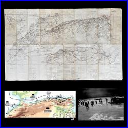
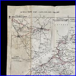
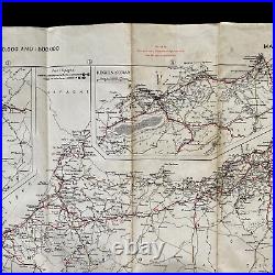
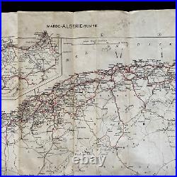
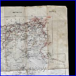
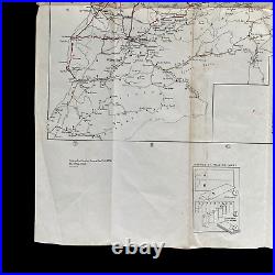
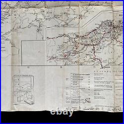
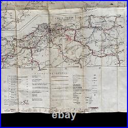
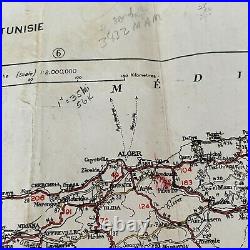
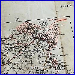
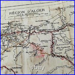

This WWII D-Day Operation Torch map was used by the Eastern Task Force and shows a beachhead landing combat marks on'CHARLIE BEACH' near Algier. This combat map also shows numerous other operational markings across the North African region. This extremely rare WWII D-Day assault map was carried during the infamous D-Day amphibious landings of Operation Torch. Operation Torch was the Allied invasion of North Africa in November 1942 was intended to draw Axis forces away from the Eastern Front, thus relieving pressure on the hard-pressed Soviet Union. The operation was a compromise between U. And British planners as the latter felt that the American-advocated landing in northern Europe was premature and would lead to disaster at this stage of the war. This heavily used and'salty' operations map was used as the primary D-Day assault and shows all of the amphibious landing areas from Casablanca by the Western Task Force (Patton) to Oran by Central Task Force (Frendenhall) to the landing areas of the Eastern Task Force (Ryder) at Algiers. This rare first edition "SHEET 151" was a very limited printed map and was issued to the Western, Central, and Eastern Task Forces prior to the D-Day landings. The map also displays a rare legend showing areas for good viewpoints, dangerous points/roads, aerodromes, seaplane bases, etc. This map played a vital role in the capture of the Axis-occupied towns and areas shown during the D-Day landings. What makes this amphibious landing map so rare is it features smaller sections of numerous other maps compiled into one. These condensed sections and simplified town and road layouts were used primarily for objective locations and movements after landing on the beaches.
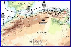
In the final plan, the Atlantic coast landing to capture Casablanca was to be made by the all-American Western Task Force under Maj. Patton, with 35,000 troops carried by a U. Navy task force sailing directly from the U.
The capture of Oran was entrusted to the Centre Task Force, which consisted of 39,000 U. Fredendall but was escorted by a British naval force.
For the operation against Algiers, the Eastern Naval Task Force was entirely British, but the Assault Force consisted of 23,000 British and 10,000 American troops under the command of U. The Allied invasion of French North Africa in November 1942 was intended to draw Axis forces away from the Eastern Front, thus relieving pressure on the hard-pressed Soviet Union.
The operation was planned as a pincer movement, with U. Landings on Morocco's Atlantic coast (Western Task Force-Safi, Fedala, Mehdia-Port Lyautey) and Anglo-American landings on Algeria's Mediterranean coast (Center and Eastern task forces-Oran, Algiers). There was also a battalion-sized airborne landing near Oran with the mission to seize two airfields.The primary objective of the Allied landings was to secure bridgeheads for opening a second front to the rear of German and Italian forces battling the British in Libya and Egypt. However, resistance by the nominally neutral or potentially pro-German Vichy French forces needed to be overcome first. After a transatlantic crossing, the Western Task Force effected its landings on 8 November.
A preliminary naval bombardment had been deemed unnecessary in the vain hope that French forces would not resist. In fact, the initially stiff French defense caused losses among the landing forces. However, by 10 November, all landing objectives had been accomplished and U. Units were poised to assault Casablanca, whose harbor approaches were the scene of a brief, but fierce, naval engagement.
The French surrendered the city before an all-out attack was launched. The Center Task Force, composed from assets based in the United Kingdom, also encountered resistance by French shore batteries and ground forces to its 8 November landings. Vichy French warships undertook a sortie from Oran's port, but were all either sunk or driven ashore. After an attempt to capture the port facilities failed, heavy British naval gunfire brought about Oran's surrender on 9 November.
Operations of the Eastern Task Force (also arriving from Britain) were aided by an anti-Vichy coup that took place in Algiers on 8 November. Thus, the level of French opposition at the landing beaches was low or non-existent. The only serious fighting took part in the port, where U. Resistance had been overcome by the evening of 10 November, when the city was surrendered to the U. The invasion of North Africa accomplished much for the Allies. Perhaps most important, American and British forces finally had seized the offensive after three years of German and Italian forces dictating the tempo of events. Now forced to fight on both its western and eastern flank, the German-Italian. Faced an additional burden of having its tenuous logistical train across the Mediterranean subjected to further attack. Bases in northwest Africa, meanwhile, could contribute to the prosecution of the anti-submarine campaign in the eastern Atlantic. The movement of some 100,000 soldiers from the United States and United Kingdom through hostile waters and on to contested shores demonstrated successful, if far from perfect, collaboration between the British and American staffs. Taken in combination with the Americans' promising campaign in the Solomon Islands and the Soviets' apparent ability to hold in the Eastern Front, the Allies were positioned significantly better in late 1942 than they had been in the early spring. As if to drive home this point, President Roosevelt, Prime Minister Churchill, and the Combined Chiefs met at Casablanca itself in January 1943 to determine the next steps for further rolling back the Axis. Despite these many positives, Torch also fell short of expectations. Tunis did not fall quickly to British and American forces. Their presence in North Africa and threatened assault of southern Europe also failed to draw away large numbers of Germans from the Eastern Front, a key strategic rationale given for the operation.At the tactical level, the assault upon Moroccan beaches revealed serious problems with the logistical, communication, and command-and-control approaches the Navy and Army employed for this major amphibious operation. The sailors and soldiers were also fortunate to face Vichy French defenders who fought with limited tenacity. To their credit, however, the American leaders acknowledged these various shortcomings and their good fortune. Almost immediately, they set to using this experience in preparation for tougher tests in the near future.
This item is in the category "Collectibles\Militaria\WW II (1939-45)\Original Period Items\United States\Field Gear, Equipment". The seller is "premierrelics" and is located in this country: US.
This item can be shipped worldwide.- Theme: Militaria
- Original/Reproduction: Original
- Conflict: WW II (1939-45)
