RARE! WWII Pattons U. S. Third Army Hand-Drawn Bastogne Battle of the Bulge Map
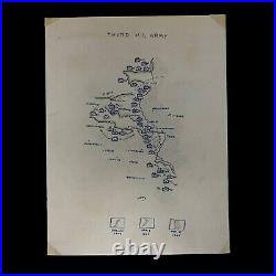

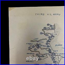
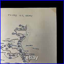
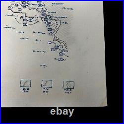
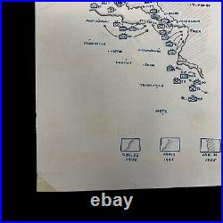
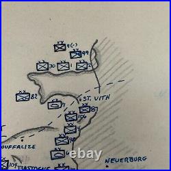
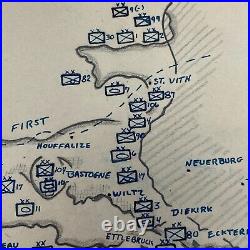
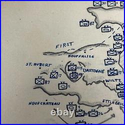
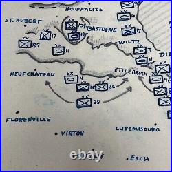
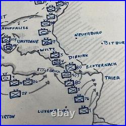
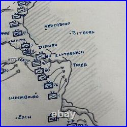
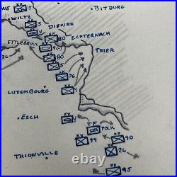
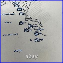
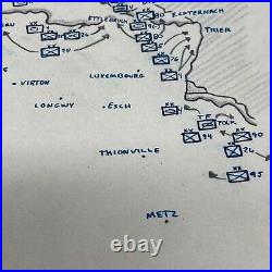
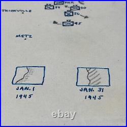

Comes with a hand-signed C. This extremely rare and museum-grade original WWII Pattons U. Third Army situation map is hand-drawn and shows a clear and simplified strategic view of the U.
Third Army's movements from December 22nd through January 31st, 1945. Situation maps like this were created using TOP SECRET and SECRET intelligence reports and front-line communications updates as the Allied forces pushed through France from the D-Day Normandy Beaches on June 6th, 1944. This situation was used by high-ranking officers of the U. Third Army and was used to make future strategic decisions during operations against Germans in France in 1944. Simplistic maps like this were hand-drawn to comprise more simplistic movement diagrams to see a more accurate picture of Division locations and movements on the front lines.
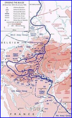
This situation map was preserved very well and remains in pristine condition given its age. This map shows Bastogne and the Battle of the Bulge. In late 1944, during the wake of the Allied forces' successful D-Day invasion of Normandy, France, it seemed as if the Second World War was all but over.Early on the misty winter morning of Dec. Seeking to drive to the coast of the English Channel and split the Allied armies as they had done in May 1940, the Germans struck in the Ardennes Forest, a 75-mile stretch of the front characterized by dense woods and few roads, held by four inexperienced and battle-worn American divisions stationed there for rest and seasoning. After a day of hard fighting, the Germans broke through the American front, surrounding most of an infantry division, seizing key crossroads, and advancing their spearheads toward the Meuse River, creating the projection that gave the battle its name. Stories spread of the massacre of Soldiers and civilians at Malmedy and Stavelot, of paratroopers dropping behind the lines, and of English-speaking German soldiers, disguised as Americans, capturing critical bridges, cutting communications lines, and spreading rumors.
For those who had lived through 1940, the picture was all too familiar. Belgian townspeople put away their Allied flags and brought out their swastikas. Police in Paris enforced an all-night curfew. British veterans waited nervously to see how the Americans would react to a full-scale German offensive, and British generals quietly acted to safeguard the Meuse River's crossings. Even American civilians, who had thought final victory was near were sobered by the German onslaught.But this was not 1940. The supreme Allied commander, Gen. Eisenhower rushed reinforcements to hold the shoulders of the German penetration.
Had turned his Third U. Army to the north and was counterattacking against the German flank.
But the story of the Battle of the Bulge is above all the story of American Soldiers. Often isolated and unaware of the overall picture, they did their part to slow the German advance, whether by delaying armored spearheads with obstinate defenses of vital crossroads, moving or burning critical gasoline stocks to keep them from the fuel-hungry German tanks, or coming up with questions on arcane Americana to stump possible German infiltrators. At the critical road junctions of St.Vith and Bastogne, American tankers and paratroopers fought off repeated attacks, and when the acting commander of the 101st Airborne Division in Bastogne was summoned by his German adversary to surrender, he simply responded, Nuts! Within days, Patton's Third Army had relieved Bastogne, and to the north, the 2nd U. Armored Division stopped enemy tanks short of the Meuse River on Christmas.
Through January, American troops, often wading through deep snow drifts, attacked the sides of the shrinking bulge until they had restored the front and set the stage for the final drive to victory. Be able to launch an offensive in the west on such a scale. An admiring British Prime Minister Sir Winston Churchill stated, This is undoubtedly the greatest American battle of the war and will, I believe, be regarded as an ever-famous American victory. Indeed, in terms of participation and losses, the Battle of the Bulge is arguably the greatest battle in American military history.
