RARE! WWII SECRET Iwo Jima Mount Suribachi Pre-Invasion Aerial Recon Photograph
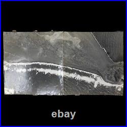
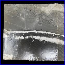
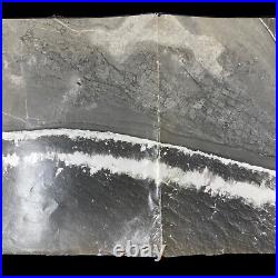
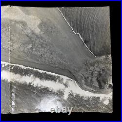

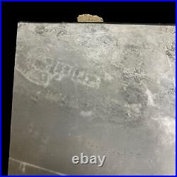

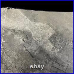

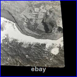
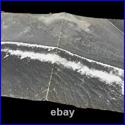
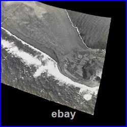
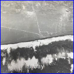


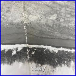
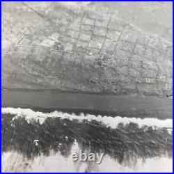
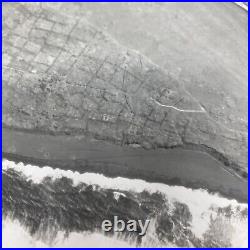
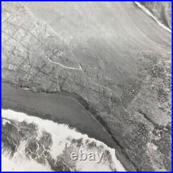
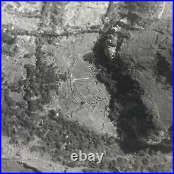
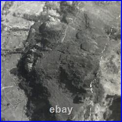
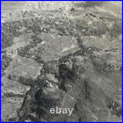
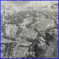

Original aerial reconnaissance photographs of Iwo Jima dating to the period of the invasion are very rare on the market. For example, a search of RareBookHub shows dozens of variations of Joe Rosenthal's iconic photograph of the flag raising on Mount Suribachi having been offered for sale, but not a single reconnaissance photo. This incredibly rare and museum-grade WWII Iwo Jima pre-invasion aerial reconnaissance photograph is only a small handful of original SECRET aerial reconnaissance photographs taken prior to the amphibious D-Day assault of Iwo Jima in February 1945. Estimated to have been taken on July 4th, 1944 this WWII Iwo Jima pre-invasion aerial reconnaissance photograph was one of the main intelligence photographs used in the creation of the infamous Iwo Jima BIGOT Beach Diagrams as prepared by the Intelligence Section, Amphibious Forces Pacific. The diagrams relied on aerial photographs made on July 4, 1944, more than seven months before the invasion.
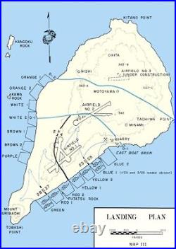
They show little in the way of manmade impediments to amphibious invasion, belying the extensive Japanese fortifications and the dogged resistance that the Marines would face from the roughly 20,000 defenders. Eschewing Japanese doctrine, which called for him to contest every inch of the landing beaches, Lieutenant General Tadamichi Kuribayashi instead instructed his soldiers to allow the American forces to land en masse, before springing traps to kill as many newly-landed troops as possible. American planners also misunderstood the nature of the volcanic sand and terrain of the beaches, most of which was thought to be perfectly suitable for disembarking and traversing. In these diagrams, particularly the one for the southwestern beaches, the volcanic sand is described as "firm" and firm enough for movement of vehicles. In reality, the ash was very difficult to traverse, and equally difficult to dig into, greatly complicating the unloading of equipment and vehicles and the excavation of foxholes and trenches. These errors were symptomatic of a general lack of accurate pre-invasion intelligence, which ultimately cost hundreds, even thousands of American lives. A select handful of SECRET pre-invasion aerial reconnaissance missions were flown over Iwo Jima to improve TARGET maps and D-Day invasion maps to brief Marine Divisions on the most updated Japanese defenses and movements.This larege pieced together intelligence section shows the proposed "SOUTHWESTERN" Iwo Jima invasion beaches of PURPLE 1, BROWN 2, BROWN 1, WHITE 2, WHITE 1, ORANGE 2, and ORANGE 1. This original aerial reconnaissance mission photograph shows the Mount Suribachi sector of Airfield No. 1 (South Japanese Air Field).
This large and pieced-together aerial photograph also shows the D-Day SOUTHEASTERN amphibious landing beaches of GREEN, RED 1, RED 2, and YELLOW 1. South Field was significant to the overall Battle of Iwo Jima. It was during the fight to secure this airfield that Medal of Honor recipient Gunnery Sergeant John Basilone was killed. Initial carrier raids against Iwo Jima began in June 1944. Prior to the invasion, the 8-square-mile island would suffer the longest, most intensive shelling of any Pacific island during the war.
The 7th Air Force, working out of the Marianas, supplied the B-24 heavy bombers for the campaign. In addition to the air assaults on Iwo, the Marines requested 10 days of pre-invasion naval bombardment.Due to other operational commitments and the fact that a prolonged air assault had been waged on Iwo Jima, Navy planners authorized only three days of naval bombardment. Unfavorable weather conditions further hampered its effects. Despite this, VADM Turner decided to keep the invasion date, 19 February 1945, as planned, and the Marines prepared for D-day.
Coarse volcanic sand hampered the movement of men and machines as they struggled to move up the beach. As the protective naval gunfire subsided to allow for the Marine advance, the Japanese emerged from their fortified underground positions to begin a heavy barrage of fire against the invading force. The 4th Marine Division pushed forward against heavy opposition to take the Quarry, a Japanese stronghold. The 5th Marine Division's 28th Marines had the mission of isolating Mount Suribachi. Both tasks were accomplished that day.
On 20 February, one day after the landing, the 28th Marines secured the southern end of Iwo and moved to take the summit of Suribachi. By day's end, one third of the island and Motoyama Airfield No. 1 was controlled by the Marines.
By 23 February, the 28th Marines would reach the top of Mount Suribachi and raise the U. The 3d Marine Division joined the fighting on the fifth day of the battle. These Marines immediately began the mission of securing the center sector of the island. Each division fought hard to gain ground against a determined Japanese defender. The Japanese leaders knew with the fall of Suribachi and the capture of the airfields that the Marine advance on the island could not be stopped; however, they would make the Marines fight for every inch of land they won.
Lieutenant General Tadamishi Kuribayashi, commander of the Japanese ground forces on Iwo Jima, concentrated his energies and his forces in the central and northern sections of the island. Miles of interlocking caves, concrete blockhouses and pillboxes proved to be some of the most impenetrable defenses encountered by the Marines in the Pacific. The Marines worked together to drive the enemy from the high ground. Their goal was to capture the area that appropriately became known as the Meat Grinder.
" This section of the island included three distinct terrain features: Hill 382, the highest point on the northern portion of the island; an elevation known as "Turkey Knob, " which had been reinforced with concrete and was home to a large enemy communications center; and the "Amphitheater, a southeastern extension of Hill 382. The 3d Marine Division encountered the most heavily fortified portion of the island in their move to take Airfield No. As with most of the fighting on Iwo Jima, frontal assault was the method used to gain each inch of ground. By nightfall on 9 March, the 3d Marine Division reached the island's northeastern beach, cutting the enemy defenses in two.
On the left of the 3d Marine Division, the 5th Marine Division pushed up the western coast of Iwo Jima from the central airfield to the island's northern tip. Moving to seize and hold the eastern portion of the island, the 4th Marine Division encountered a "mini banzai" attack from the final members of the Japanese Navy serving on Iwo. This attack resulted in the death of nearly 700 Japanese and ended the centralized resistances of enemy forces in the 4th Marine Division's sector. The 4th Marine Division would join forces with the 3d and 5th Marine Divisions at the coast on 10 March. Operations entered the final phases 11 March.
Enemy resistance was no longer centralized and individual pockets of resistance were taken one by one. Finally on 26 March, following a banzai attack against troops and air corps personnel near the beaches, the island was declared secure. Army's 147th Infantry Regiment assumed ground control of the island on 4 April, relieving the largest body of Marines committed in combat to any one operation during World War II.
Background: The invasion of Iwo Jima. Iwo Jima, whose name translates as "Sulfur Island, " was an important midway point between South Pacific bomber bases that were already in the hands of the Allies and the Japanese home islands. 700 miles from Tokyo and 350 from the nearest U. Airbase, with a central plain suitable for large runways, American planners viewed it as a valuable target. Following months of bombardment, the 4. Marine Divisions began landing on the island on February 19, 1945. Despite the sophistication of the American intelligence effort and the overwhelming force brought to bear, the invasion was extraordinarily costly.American planners failed to understand the defensive strategy of Japanese General Kurabayashi or the complexity and extent of the Japanese fortifications, which included a huge network of linked underground bunkers, well-hidden and -protected artillery positions, interlocking fields of fire, and some 11 miles of tunnels. They also vastly overestimated the impact of the months-long pre-invasion bombardment, which left these fortifications largely intact on the day of the invasion. Indeed, one recent writer quotes Admiral Chester Nimitz, American Commander-in-Chief, Pacific, as having said Well, this will be easy. The Japanese will surrender Iwo Jima without a fight.
Derrick Wright, The Battle for Iwo Jima, p. The battle for the island was among the bloodiest of the Pacific Theater of the Second World War. In total, more than 6,800 U. Marines lost their lives and more than 19,000 were wounded, while a staggering 18,000 of the roughly 20,000 Japanese defenders were killed. In light of these terrible losses, there was, and still is, dispute about whether the invasion had been merited.In all, a rare photographic artifact from one of the great battles of the Second World War.
